Back
Back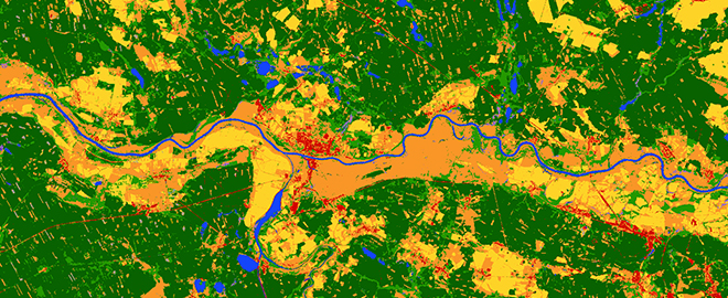
By the decision of ESA, the map developed by the Space Research Centre of the Polish Academy of Sciences will be included, as one of the few selected, in the resources of the newly formed Copernicus Data Space Ecosystem, combining data from both the Copernicus Open Access Hub and the DIAS repository.
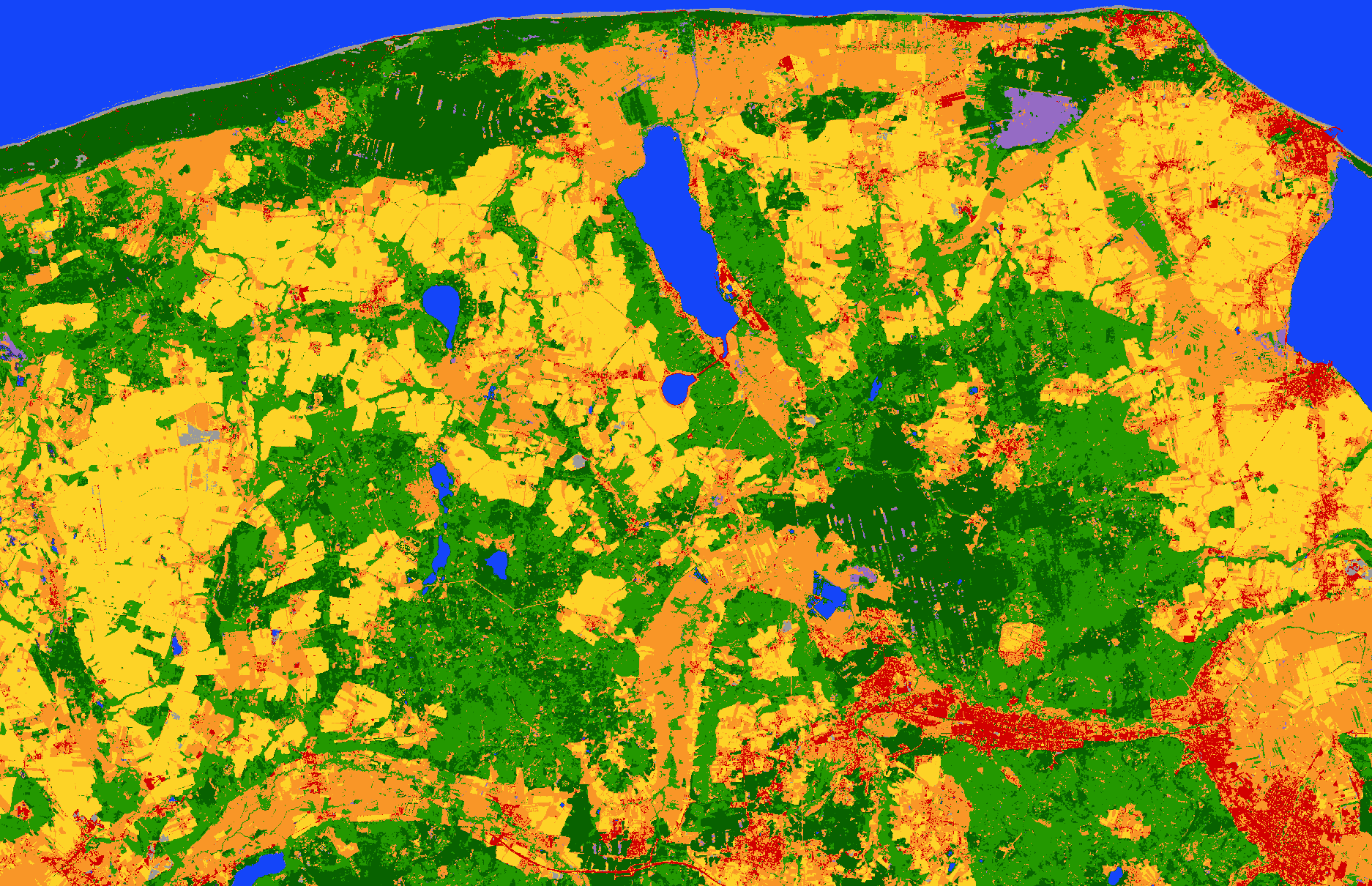
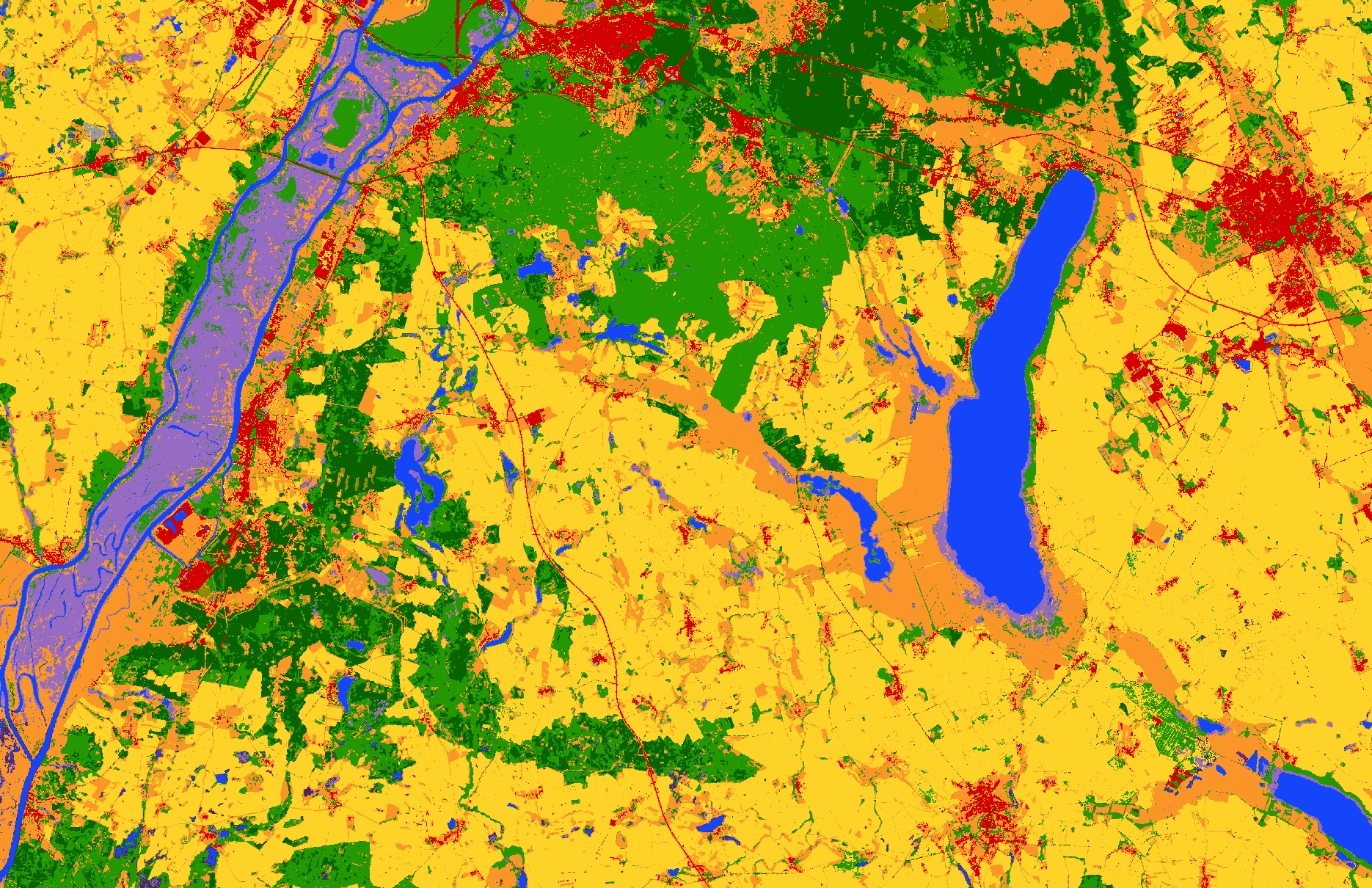
The methodology developed by The Space Research Centre of the Polish Academy of Sciences (CBK PAN), adapted for national needs (S2GLC PL), is currently being successfully used by the Polish Space Agency. Maps of Poland’s land coverage for the years 2019, 2020, 2021, and 2022 were prepared for the Agency. Similar to the 2017 map of Europe, these maps were generated through an automated classification process of multispectral Sentinel-2 satellite images (S2GLC). The Copernicus program satellites cover the European area every 5 days and approximately 70 times a year, enabling the selection of a sufficient number of images for the map, regardless of cloud cover, which is a significant challenge in optical imaging. Thanks to the initiative of the Polish Space Agency, which involves cyclical and regular land coverage observations, the update of existing databases and the detection of changes in the landscape, including monitoring built-up areas, road infrastructure, forested areas, water reservoirs, etc., are made possible.
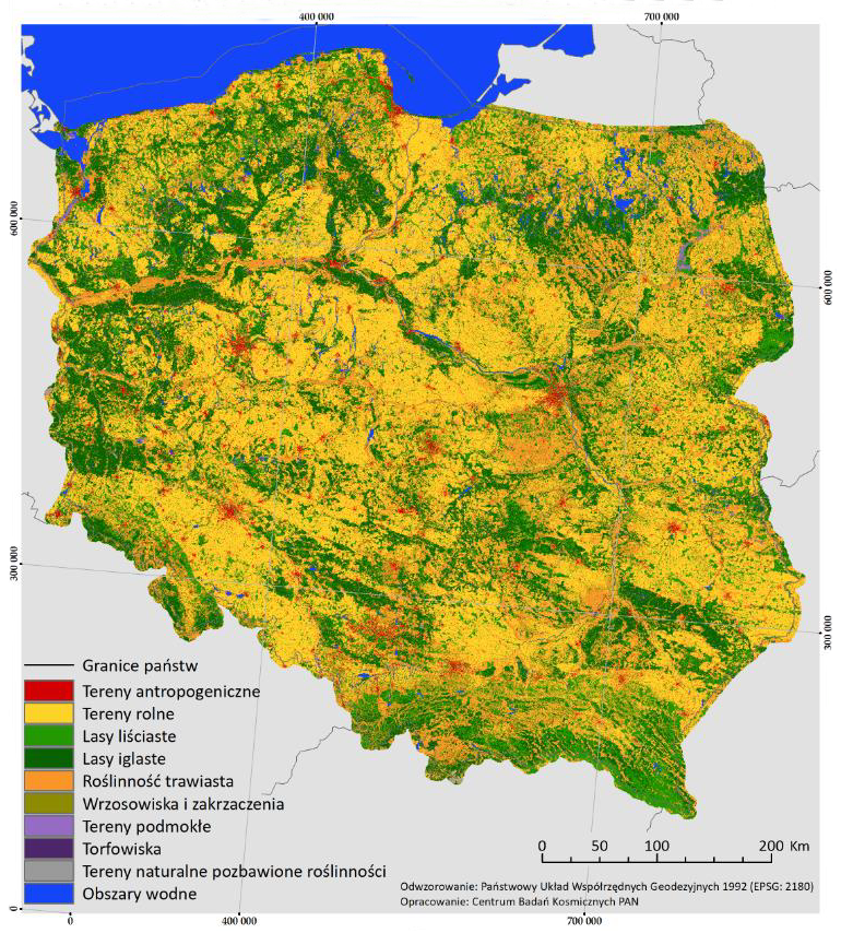
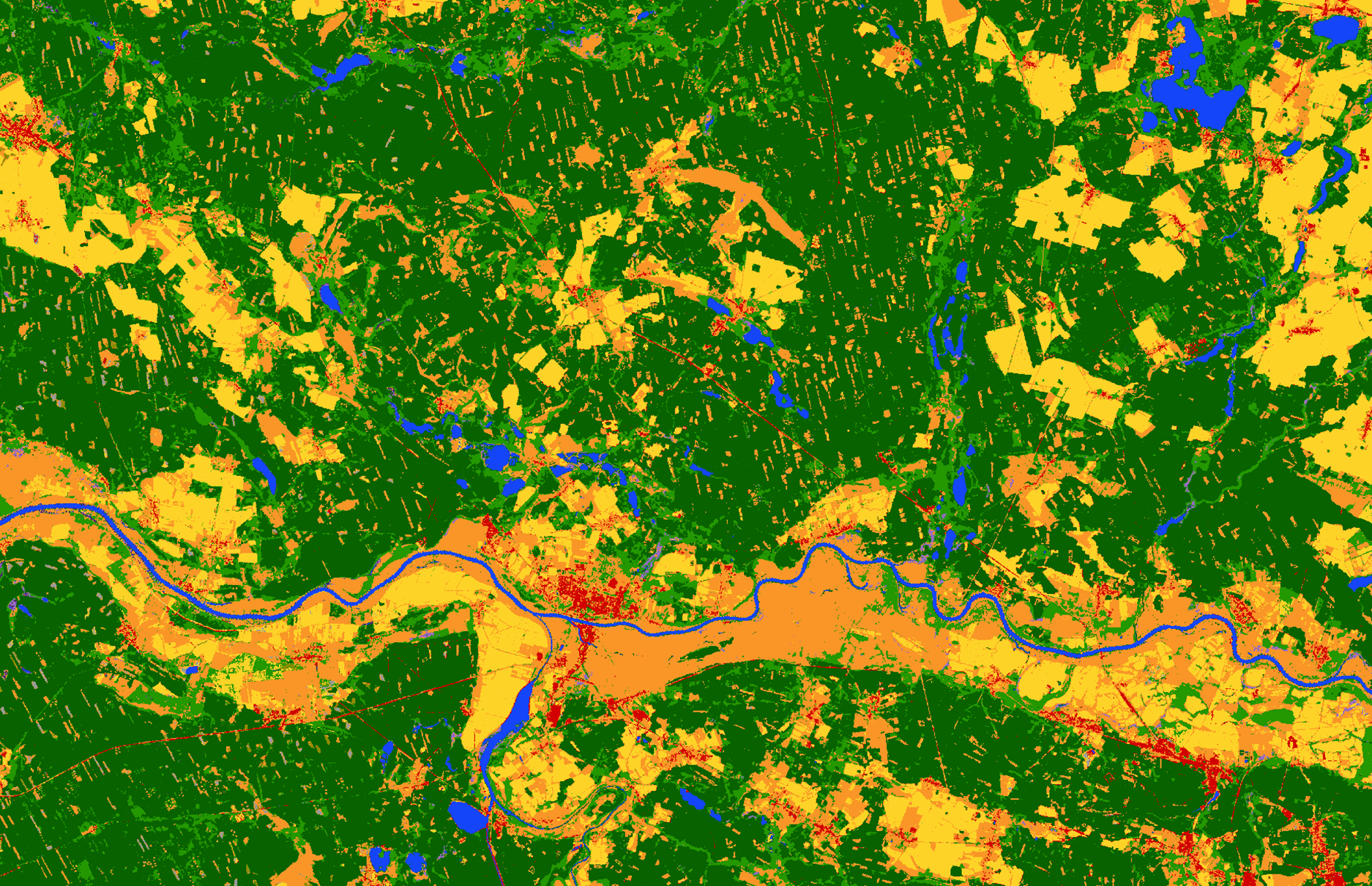
Poland Land Coverage Map 2022
Images for the years 2019-2021 present land coverage in a resolution of 10 meters, divided into 10 classes: anthropogenic areas, agricultural areas, deciduous forests, coniferous forests, grassland vegetation, heathlands, wetlands, peat bogs, natural areas devoid of vegetation, and water bodies. The 2022 Poland Land Coverage Map was also generated through an automated classification process of multispectral Sentinel-2 satellite images. The processing is based on a series of images captured during the vegetation period (spring, summer, autumn – from early April to mid-October 2022), with cloud cover of less than 50 percent.
2017 Europe Map
The 2017 Europe Map presents land coverage across Europe in the year 2017 and includes 13 land coverage classes, such as agricultural areas, deciduous forests, coniferous forests, built-up areas, marshes, and peat bogs. This map was developed based on automated processing of multispectral data from Sentinel-2 satellites, using machine learning. The creation of the map involved the use of up to 15,000 satellite images, resulting in a resolution of 10 meters and a land coverage classification accuracy ranging from 86% to 89% for Europe and 93% for Poland.
Availability of Land Coverage Maps on geoportal.gov.pl
The project’s results have been implemented into the cyclical observation of land coverage in Poland and, at the request of the Polish Space Agency, maps of land coverage for 2019-2022, created according to the S2GLC PL methodology, are universally accessible and free of charge for domestic users. They have been made available in the national spatial information node and the academic network of the Warsaw University of Technology CENAGIS.
GUGIK (Main Office of Geodesy and Cartography) reports that these maps are highly popular among users, indicating not only a demand for high-quality land coverage maps, but also confirming the significant scientific achievement of the Space Research Centre of the Polish Academy of Sciences in promoting the use of satellite data.
Land Coverage Maps in the National Satellite Information System
Land coverage maps are now universally and freely accessible in the National Geoportal (www.geoportal.gov.pl), managed by the Head Office of Geodesy and Cartography. All land coverage maps previously provided by the Polish Space Agency can be found in the “Data from Other Institutions” folder under “Polska Agencja Kosmiczna” with the names “Land Coverage Classification 2019,” “Land Coverage Classification 2020,” and “Land Coverage Classification 2021.” The data is accessible via the WCS service standard or the WMS service standard.
Soon, all studies related to land coverage in Poland and changes in land coverage starting from 2019, prepared at the request of the Polish Space Agency, will be available in the National Satellite Information System.
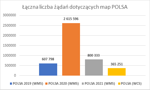
Chart 1. Total Number of Requests Recorded on geoportal.gov.pl Regarding POLSA Maps – as of December 2022
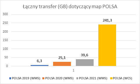
Chart 2. Total Data Transfer Related to POLSA Maps Recorded on geoportal.gov.pl – as of December 2022″
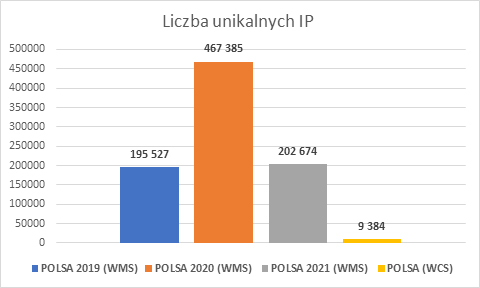
Chart 3. Number of Unique IP Addresses Recorded for POLSA Maps on geoportal.gov.pl – as of December 2022